Mapping Your Lake with Sonar: Find Fish and Structure Faster
Mapping your lake is one of the most effective ways to locate fish, structure, and underwater features. By creating a digital map of the bottom, you can identify drop-offs, humps, weed edges, and other prime fish-holding locations.
This summary will teach you:
Why mapping is important for anglers
How to use 2D, CHIRP, Side Imaging, and Down Imaging for mapping
Tips for creating accurate maps and storing data
Common mistakes to avoid when mapping lakes
With proper lake mapping, you can spend less time guessing and more time catching, giving you a major advantage over other anglers.
SECTION: WHY MAPPING YOUR LAKE MATTERS
Mapping your lake allows you to:
Locate structure like drop-offs, rocks, humps, and submerged logs
Identify weed edges and vegetation patterns where fish hide
Pinpoint suspended fish zones
Plan fishing trips more efficiently with waypoints and depth contours
Anglers who map lakes consistently catch more fish because they know exactly where fish are likely to hold.
Links:
Fish vs structure vs weeds → for identifying structure and fish
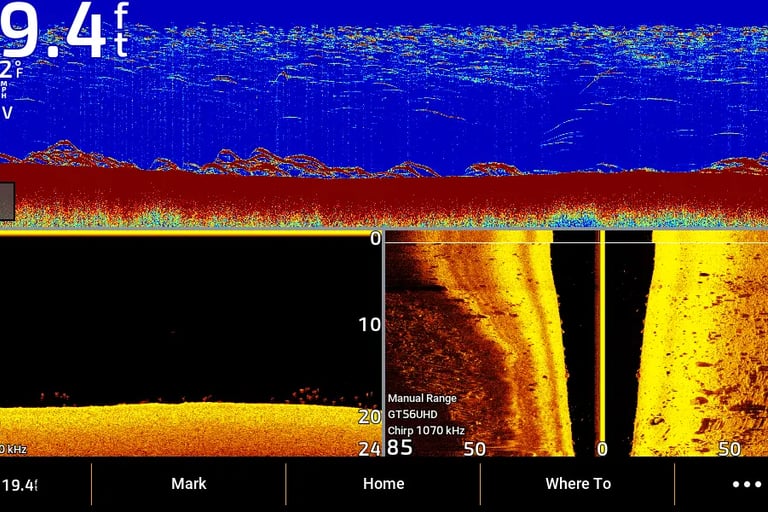
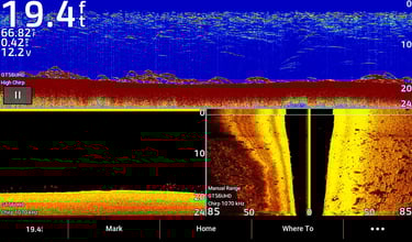
How to read sonar
Sonar mapping showing drop-offs and weed edges
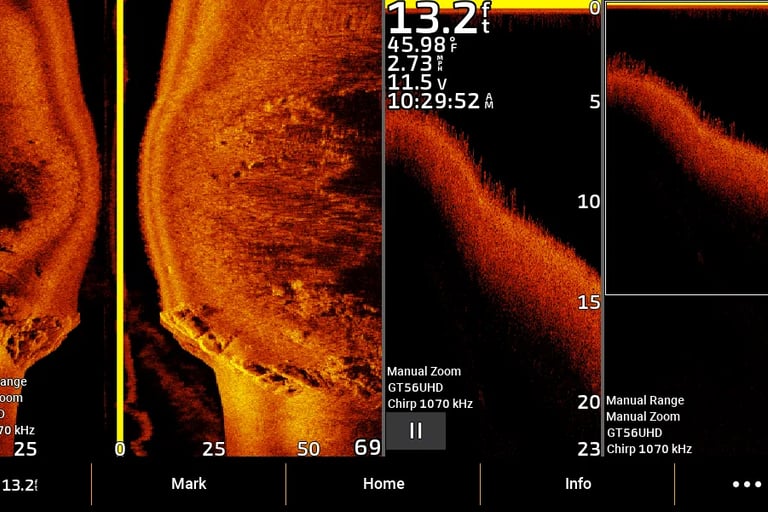
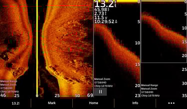
SECTION: TOOLS FOR LAKE MAPPING
To map a lake effectively, you’ll need:
2D / CHIRP sonar: For bottom contours and fish arches
Side Imaging (SideVü): For scanning wide areas along the sides of the boat
Down Imaging (ClearVü): For vertical structure and suspended fish
Waypoints & GPS: To mark key fishing spots and structure
Pro Tip: Use a combination of imaging types for complete coverage — 2D gives depth accuracy, Side Imaging reveals edges and structure, Down Imaging confirms fish suspending above the bottom.
Internal links:
2D CHIRP sonar guide → 2D / CHIRP guide
Side imaging sonar guide → Side Imaging guide
Down imaging sonar guide → Down Imaging guide
Sonar screens showing 2D, Side Imaging, and Down Imaging used for mapping
SECTION: CREATING AN ACCURATE MAP
Steps to create accurate lake maps:
Plan transects: Drive parallel lines across the lake to cover the area evenly
Maintain steady speed: 3–5 mph for Side Imaging, slower for Down Imaging
Adjust range and sensitivity: Ensure clear images of bottom and structure
Mark waypoints: Log key spots like humps, drop-offs, weed edges, and fish sightings
Combine sonar views: Side Imaging shows horizontal layout, Down Imaging shows vertical detail
Links:
Beginner sonar settings for sonar setup tips
How to read sonar for interpreting readings
Once your lake is mapped:
Target drop-offs, ledges, and humps where fish suspend
Fish weed edges and transitions revealed by Side Imaging
Revisit productive waypoints based on seasonal patterns
Mapping gives you a repeatable advantage, making every trip more productive.